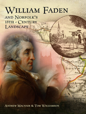
William Faden and Norfolk's Eighteenth Century Landscape
ebook ∣ A Digital Re-Assessment of his Historic Map
By Andrew Macnair

Sign up to save your library
With an OverDrive account, you can save your favorite libraries for at-a-glance information about availability. Find out more about OverDrive accounts.
Share

Find this title in Libby, the library reading app by OverDrive.


Search for a digital library with this title
Title found at these libraries:
| Library Name | Distance |
|---|---|
| Loading... |
William Faden's map of Norfolk, published in 1797, was one of a large number of surveys of English counties produced in the second half of the eighteenth century. This book, with accompanying DVD, presents a new digital version of the map, and explains how this can be interrogated to produce a wealth of new historical information. It discusses the making of the Norfolk map, and Faden's own career, within the wider context of the eighteenth-century "cartographic revolution". It explores what the map, and others like it, can tell us about contemporary social and economic geography. But it also shows how, carefully examined, the map can also inform us about the development of the Norfolk landscape in much more remote periods of time. The book includes a digital version of the map, on DVD. Andrew Macnair is Research Fellow at the School of History in the University of East Anglia; Tom Williamson is Professor of History and Head of the Landscape Group at the University of East Anglia.
Share


