
Sign up to save your library
With an OverDrive account, you can save your favorite libraries for at-a-glance information about availability. Find out more about OverDrive accounts.
Share

Find this title in Libby, the library reading app by OverDrive.


Search for a digital library with this title
Title found at these libraries:
| Library Name | Distance |
|---|---|
| Loading... |
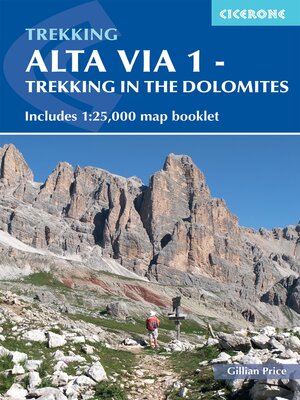
The Alta Via 1 is one of Italy's most famous and most popular long-distance routes and is the easiest of six Alta Via routes that traverse the magnificent Dolomites. The hut-to-hut trail extends 115km from Lago di Braies to La Pissa, boasting spectacular alpine vistas. Although it demands a moderate level of fitness, it is well waymarked and follows clear well-trodden paths, making for an ideal introduction to trekking in the Dolomites. Welcoming refuges offer meals and accommodation along the way, though camping is also possible on the middle stages (restrictions apply elsewhere). The route is presented in 11 stages, each with overview statistics, a brief summary of the day's walking and detailed route description illustrated with clear mapping. There are also comprehensive notes on the huts the route passes, with contact details and tips on facilities available. The intro includes advice on transport, accommodation and equipment, plus suggestions for creating shorter itineraries should time be limited, and there are facts about local points of interest and background information on the region's geology, plants and wildlife. A handy map booklet is also included, showing the full route of AV1 on 1:25,000 Kompass mapping, so you don't have to carry paper maps. Famed for their striking jagged peaks and sheer rock faces, the Dolomites also bear stark reminders of the turbulent World War I years in the shape of trenches and barracks. The AV1 is a wonderful way to experience the celebrated scenery: (weather permitting) an estimated 80% of the Dolomites can be seen from the trail, with highlights including fantastic views of the Tofane, Pelmo and Civetta and the iconic Marmolada with its glacier. If this is your first visit to the region, you'll soon see why so many fall under its spell!
Share


