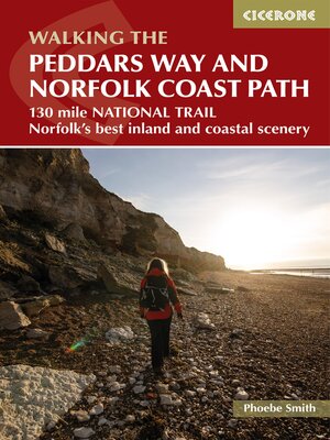
The Peddars Way and Norfolk Coast Path
ebook ∣ 130 mile national trail--Norfolk's best inland and coastal scenery
By Phoebe Smith

Sign up to save your library
With an OverDrive account, you can save your favorite libraries for at-a-glance information about availability. Find out more about OverDrive accounts.
Share

Find this title in Libby, the library reading app by OverDrive.


Search for a digital library with this title
Title found at these libraries:
| Library Name | Distance |
|---|---|
| Loading... |
A guidebook to walking the 216 km (133 miles) Peddars Way and Norfolk Coast Path National Trail that combines Norfolk's inland and coastal scenery. The route can be completed in eleven days with the possibility of breaking the walk into shorter sections.
Described in 11 stages, the distance covered spans between 12 and 29 kms (6-18 miles) each day. The Peddars Way is followed from south to north, starting at Knettishall Heath in Suffolk and joining the Norfolk Coast Path at Holme-next-the-Sea. The route ends at Hopton-on-Sea on the Norfolk-Suffolk border.
Share


