The Swiss Alpine Pass Route--Via Alpina Route 1
ebook ∣ Trekking East to West across Switzerland
By Kev Reynolds

Sign up to save your library
With an OverDrive account, you can save your favorite libraries for at-a-glance information about availability. Find out more about OverDrive accounts.
Share

Find this title in Libby, the library reading app by OverDrive.


Search for a digital library with this title
Title found at these libraries:
| Library Name | Distance |
|---|---|
| Loading... |
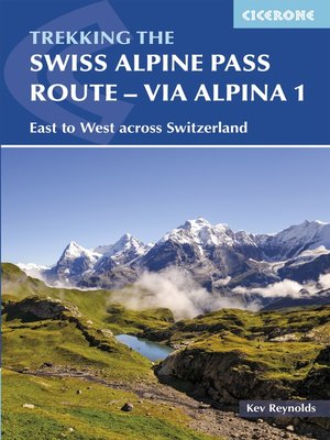
This guidebook presents the stunning Alpine Pass Route, now fully waymarked as Via Alpina 1. The 360km trail traverses Switzerland from east to west, from Sargans near the Liechtenstein border to Montreux on Lac Leman (Lake Geneva). Crossing sixteen Alpine passes, it showcases some of the country's most breathtaking mountain landscapes, boasting views of iconic peaks such as the Wetterhorn, Eiger, Jungfrau and Les Diablerets. The route is suitable for those with some experience of Alpine trekking: it amasses over 20,000m of ascent and involves some steep sections. It can be completed in 2-3 weeks, although it is also possible to walk shorter sections; alternatively postbus, cable-car and rail connections could be used to allow for a tighter schedule. The route is presented in 18 stages, each featuring step-by-step route description accompanied by 1:100,000 mapping, route profiles and notes on transport, accommodation and facilities. In addition, a 26km prologue in Liechtenstein and an alternative finish following the old course of the Alpine Pass Route via Gsteig are also described. Accommodation options range from mountain huts to hotels and inns, with camping available at a number of licensed sites along the route.
Share


