The Tasman Map
ebook ∣ Abel Tasman, the Dutch East India Company and the first Dutch discoveries of Australia
By Ian Burnet

Sign up to save your library
With an OverDrive account, you can save your favorite libraries for at-a-glance information about availability. Find out more about OverDrive accounts.
Share

Find this title in Libby, the library reading app by OverDrive.


Search for a digital library with this title
Title found at these libraries:
| Library Name | Distance |
|---|---|
| Loading... |
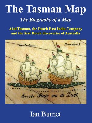
The Tasman Map is an icon of early Dutch cartography and shows the first European discoveries of Australia. Based on sixteen separate discoveries, the first map of Australia took shape over a period of only forty years, from 1606 to 1644. It shows a recognisable outline of the north, west, and south coasts of Australia that was not to change for another 125 years until the arrival of the British explorer James Cook.
The version of the map held by the Mitchell Library in Sydney, Australia, is hand-drawn on delicate Japanese paper and is thought to have been specially prepared for presentation to the Amsterdam Chamber of the Dutch East India Company. Every visitor who passes through the vestibule of the Mitchell Library stops to admire the magnificent marble mosaic of the Tasman Map, which fills the entire vestibule floor and shows Abel Tasman's voyages of exploration around Australia in 1642/43 and 1644.
Share


